Project Description
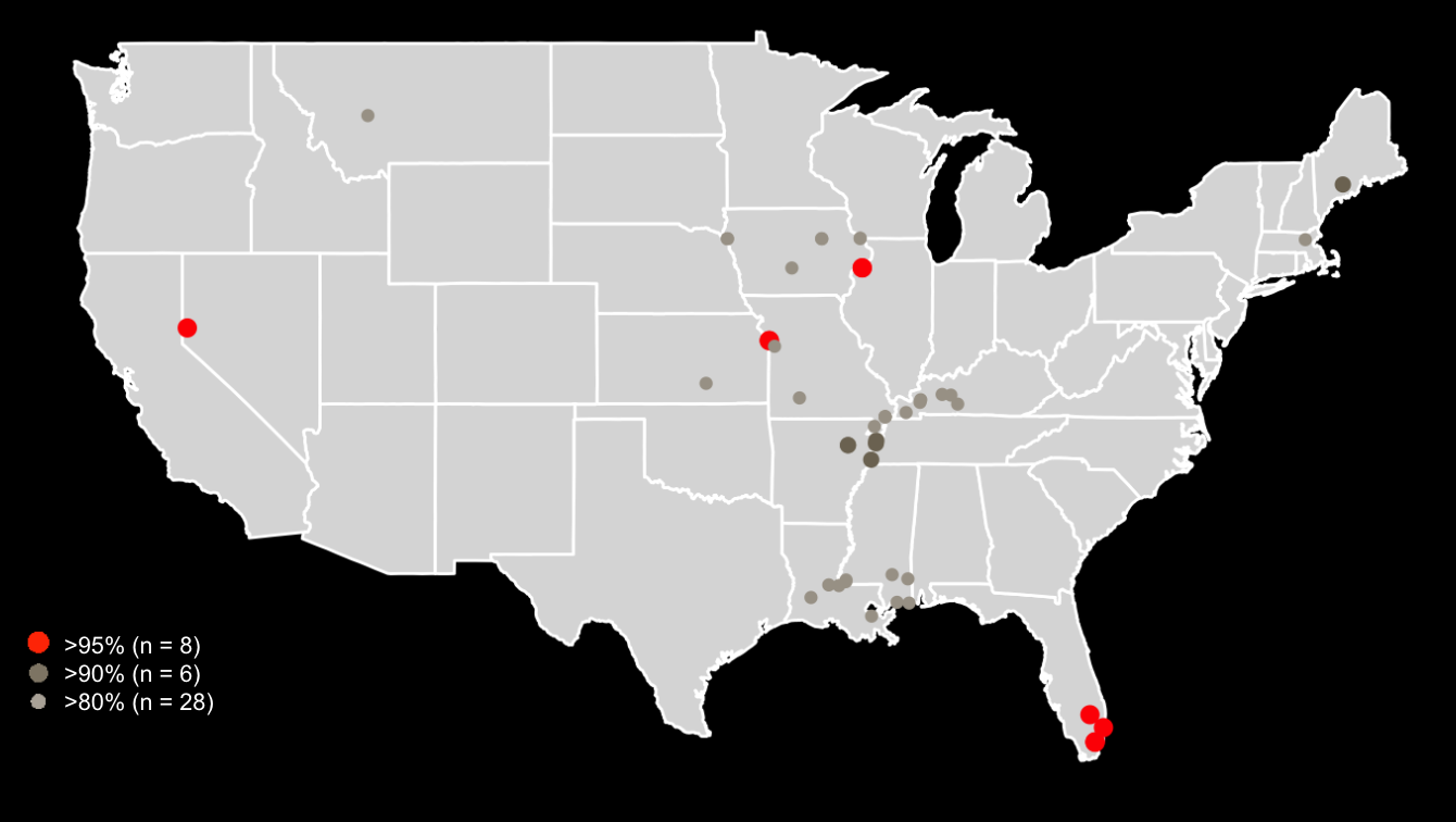
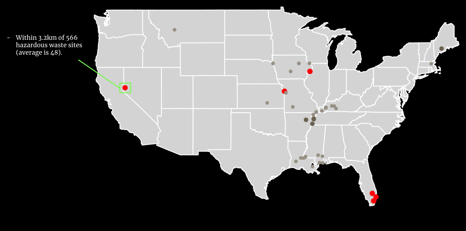
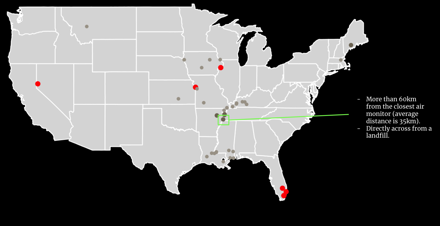
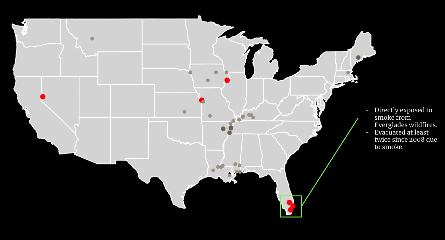
Poor air quality, especially fine particulate matter smaller than two and a half microns in width (PM2.5), leads to thousands of annual deaths in the US. It also contributes to increased risks of cardiovascular disease, respiratory infections, asthma, and lung cancer. Carceral facilities may be particularly prone to high PM2.5 levels due to poor ventilation and construction close to industrial land uses, leading to the perpetuation of environmental injustice against a largely Black, Hispanic, and low-income population in captivity. Federal funding initiatives designed to address environmental disparities often use the Environmental Protection Agency's Environmental Justice Screening and Mapping Tool (EJScreen) to identify high PM2.5 concentrations. However, EJScreen relies on sparsely located ground-based sensors which may not capture the full extent of PM2.5 exposure, especially for people who are incarcerated. We study PM2.5 levels in the areas surrounding carceral facilities using Washington University’s Surface PM2.5 dataset, which integrates satellite observations, atmospheric modeling, and ground based data to achieve a higher resolution than EJScreen. We identify close to 50 carceral facilities burdened with high PM2.5 using the WashU dataset that were previously unrecognized by EJScreen, demonstrating the comparative strengths of satellite-derived data for environmental justice applications.


