Project Description
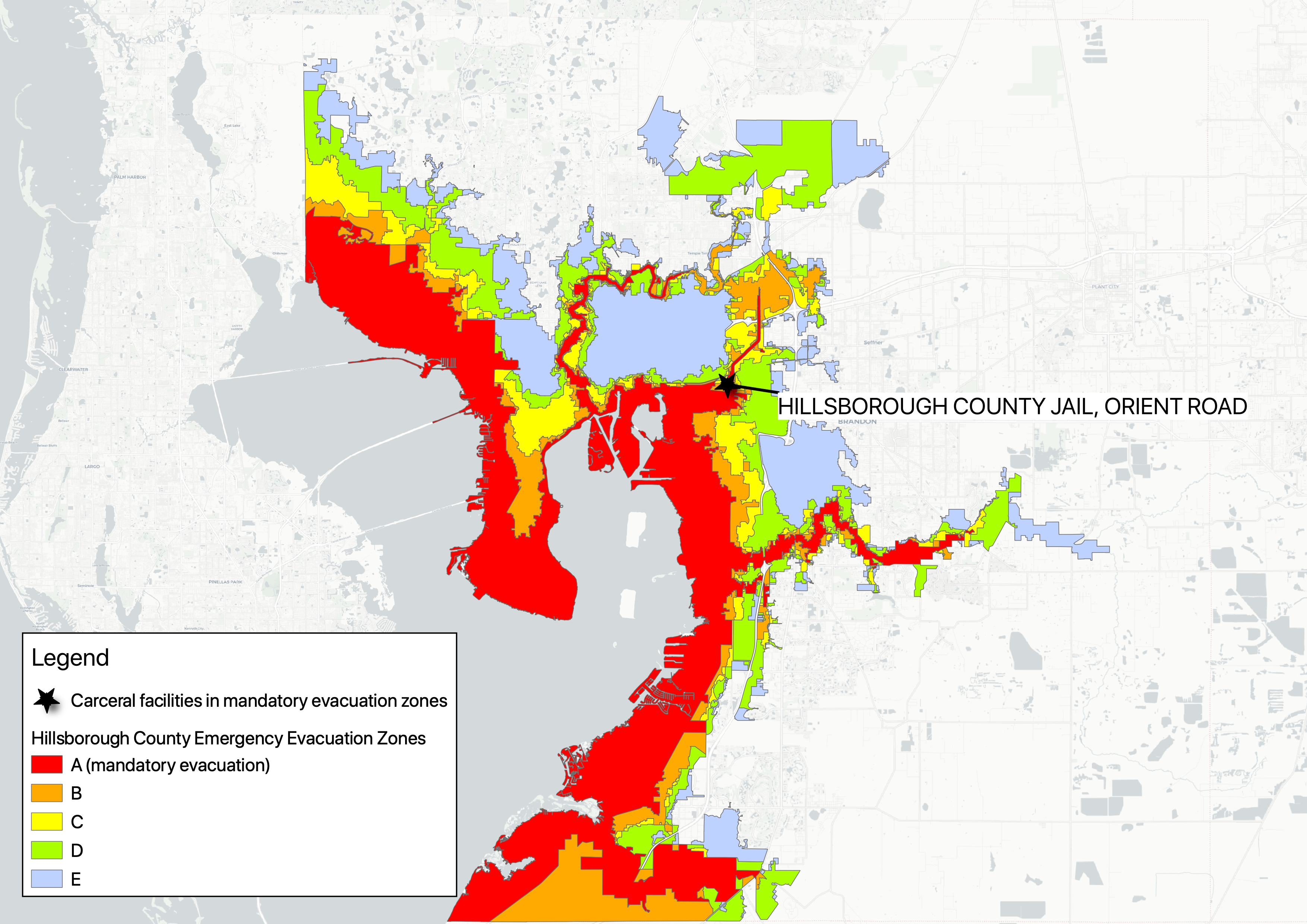
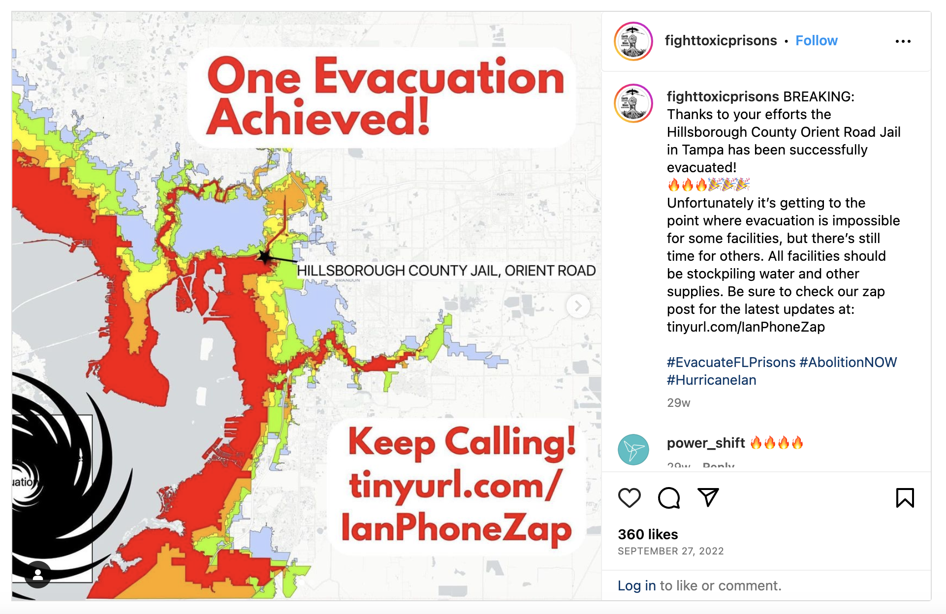
Remote sensing and GIS present generative opportunities for advancing prison ecology scholarship and social change, particularly through participatory research methods. In September 2022 when Hurricane Ian was set to impact Florida, I collaborated with the Campaign to Fight Toxic Prisons to develop a map that used satellite-derived data and GIS to identify that Hillsborough County Jail was in a mandatory evacuation zone (see Figure). Upon calling staff to see if they planned to evacuate, organizers recounted that the staff ‘laughed’, indicating an absence of any such procedure. After widely distributing imagery on social media showing the jail at risk and mounting public pressure via a phone zap, the jail officials reported that they would indeed evacuate. While we cannot prove that the jail evacuated as a result of the organizing, we see remote sensing and mapping is effective for documenting injustice, motivating public participation, and contesting the state.